

Ten Years of Research in Eastern Europe
The year 2026 marks the 11th year of research where we use science, mainly geophysics, to uncover the history of Holocaust sites in Eastern Europe. I am the co-director of a cross-disciplinary team of a scientists, and over the years a revolving array of students, that have worked at over 25 sites in Poland, Lithuania and Latvia. Our current team is made up of academic researchers from Duquesne University and the University of Wisconsin-Eau Claire, and previous participating academic institutions include the University of Hartford, Christopher Newport University, Indiana University, and the University of British Columbia. Geophysicists from BGC Engineering Canada and archaeologist from the Israel Antiquities Authority also participated, as well as our local partners including Vistula University (Poland), the Jewish Community of Lithuania, the Museum of Jews in Latvia, the Jewish Community of Latvia, the Liepaja Jewish Heritage Foundation, and the Uniting Foundation (Latvia).
This research would not be possible without funding provided by various agencies that have supported Duquesne University’s efforts to use science to uncover history. This includes the Henry Leach Foundation and the Uniting Foundation, and recently, in 2025, the Conference on Jewish Material Claims Against Germany, supported by the German Federal Ministry of Finance, and in 2026 the International Holocaust Remembrance Alliance (IHRA).


What follows is a brief description of the Holocaust sites where research has been conducted over the past 10 years. That is followed by more extensive information about the ongoing projects from 2025, and 2026.
Poland
Krasińskich Park: Jewish prisoners of the Warsaw Ghetto believed they were going to be wiped out of existence, so they secretly collected and preserved documents that told the story of life in the Warsaw Ghetto. This cache of documents came to be known as the Ringelblum Archive. Emanuel Ringelblum, a Jewish historian and political activist, collected over 35,000 pages of documents which he hid in nine zinc boxes and three metal milk cans in the Warsaw Ghetto. So far, all the zinc boxes have been recovered, but only two milk cans. Some sources suggest the last milk can is buried near where the Brush Makers Factory complex which once existed near 34 Świetojenska Street where part of the Krasińskich Park is now located. Excavations in the park in October 2021 located numerous artifacts indicative of life in the Warsaw Ghetto, but the milk can that contained documents from the Ringelblum Archive was not found
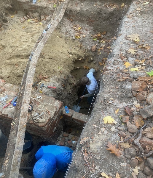
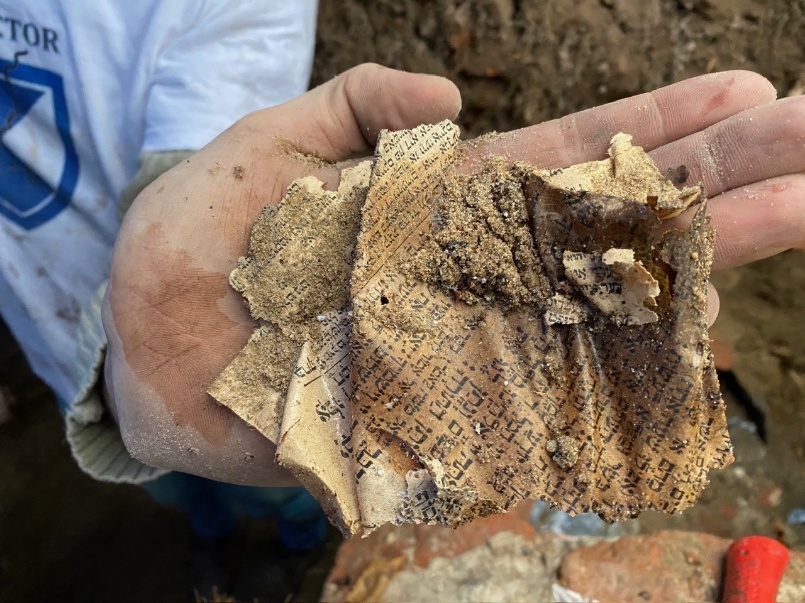
The Bersohn and Bauman Children's Hospital: Located at 51 Śliska and 60 Sienna Streets, this hospital was one of the only medical facilities permitted to operate in the Warsaw Ghetto. Founded in the 1870s, its staff fought typhus and starvation during the Holocaust. The hospital is famous for smuggling out secret clinical research on the biological effects of starvation before most staff and patients perished in 1942. Our research attempted to locate any mass graves that may exist on the hospital property. No mass graves were discovered.
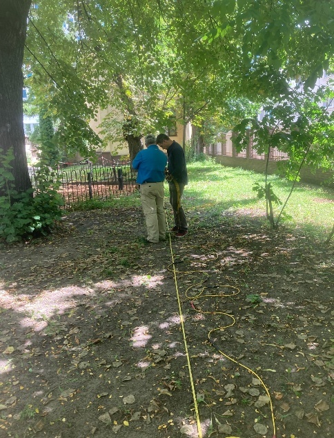
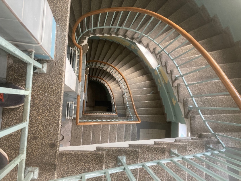
Mila 18: This area, now located near the intersection of Miła and Dubois Streets in the Warsaw Ghetto, was closely linked to the activities of the Jewish resistance movement in World War II. Historical records indicate that the basement of the tenement house at 18 Miła Street housed an extensive complex of shelters and bunkers, which served as hiding places and a base for members of the resistance group the Jewish Combat Organization. Located in the Muranów district of Warsaw, this site has proven to be one of the most important places for research into the history of the Warsaw Ghetto, and the 1943 Ghetto Uprising. Extensive archaeological investigations have been completed at this site, in part based on our research, and the site of these excavations is now open to the public.
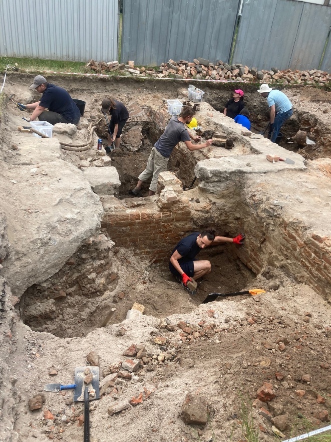
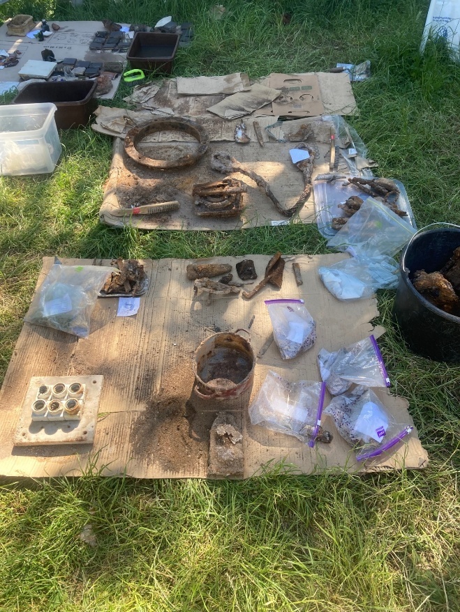
Krysia Bunker: This underground shelter located at Grójecka Street in Warsaw, was where dozens of Jews hid during the German occupation in World War II. Among those hiding there was Emanuel Ringelblum, with his wife and son. In March 1944, the location of the bunker was disclosed to German officials, and the shelter was discovered and the Jews hiding in the bunker were murdered. We unsuccessfully attempted to find the exact location of the bunker using the geophysical tools ground penetrating radar (GPR) and electrical resistivity tomography (ERT).
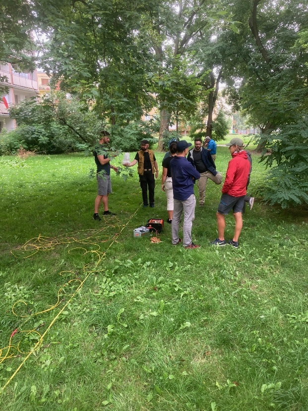
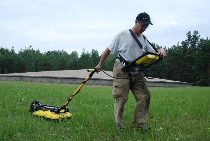
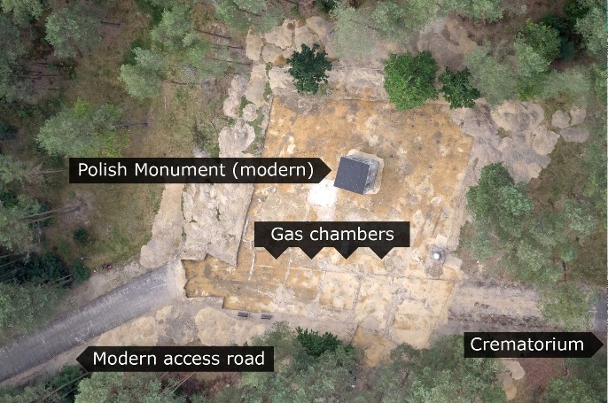
The Sobibor Extermination Camp: Operated by Nazi Germany from May 1942 to October 1943 in occupied eastern Poland, Sobibor was a secret extermination camp where approximately 180,000 to 250,000 Jews were murdered. The camp was a heavily guarded, industrialized killing center where Jews were murdered in gas chambers soon after arrival at the camp. Our research focused on finding the location of the gas chambers using GPR and ERT. Based in part on our research, in 2014, an international team of archaeologists found the location of the gas chambers. The 2023 documentary “Deadly Deception at Sobibor (trailer)” chronicles the story of Sobibor, and the search for the location of the camps gas chambers.
Lithuania
The Great Synagogue of Vilnius: The Great Synagogue is a former Orthodox Jewish congregation and synagogue which once stood at the end of Jewish Street in Old Town Vilnius. The Renaissance and Baroque style structure was completed in 1633 and operated as a synagogue until it was heavily damaged by Nazi Germany in 1941. The ruins of the former synagogue were still standing in 1945, but they were destroyed by the Soviets in 1947, and eventually a kindergarten and a primary school were built on the site in 1957. We first did GPR and ERT research at the site in 2015, and the results of this research formed the basis for limited archaeological excavations at the site. The former school at the site was demolished in early 2026, and a full-scale excavation is taking place at the site in July 2026. Also, a documentary was completed in 2025 titled “The Secrets of the Great Synagogue of Vilna,” which features some of our research, is narrated in French, with some parts in English, and English subtitles can be turn on manually for the video.
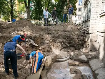
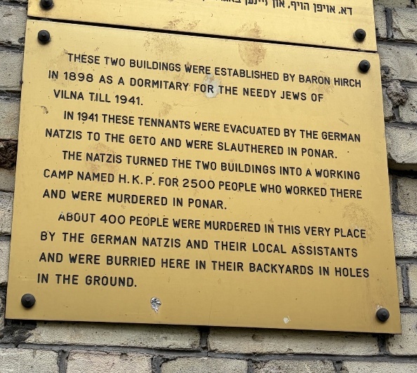
Heereskraftfahrpark (HKP): Better known as HKP 562, this site was the location of a Nazi forced labor camp in Vilnius where Jews were housed that worked as slave labor in Heereskraftfahrpark (HKP) 562 (Army Motor Vehicle Repair Park 562) from September 1943 until July 1944. It was centered around 47 & 49 Subačiaus Street, in apartment buildings originally built to house poor members of the Jewish community. HKP 562's commanding officer, Major Karl Plagge, was sympathetic to the plight of his Jewish workers, and Plagge made efforts to protect the Jews of the camp, and over 250 Jewish men, women and children survived the final liquidation of the camp in July 1944 because of these efforts, which was the single largest group of Jewish survivors of the Holocaust in Vilnius. We completed GPR and ERT at this site and several temporary mass graves and hiding places used by the Jews were discovered. More details about this research can be found in the article “Investigations at the Heereskraftfahrpark (HKP) 562 Forced-Labor Camp in Vilnius, Lithuania” and the documentary “The Good Nazi.”
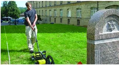
Jacob Gens Burial Site: Jacob Gens, the head of the Vilnius Ghetto Police Force, and eventually the entire Ghetto during the Holocaust, was murdered on 14 September 1943 by the head of the Vilnius Gestapo. Historical documents and Holocaust survivor testimonies indicate that he was killed at a site that became known as the Rasu Street Prison, and not the Gestapo Headquarters, as it is widely believed. In 2016, research was completed at the Rasu Street Prison site using GPR and ERT to locate subsurface reflection patterns that possibly indicate the location of where Jacob Gens is buried. Although the remains of Jacob Gens were not located, a forgotten 18th century cemetery was discovered, which is recounted in the article “Interconnected Histories: Searching for Jacob Gens’ Grave and Instead Finding a Forgotten Early 18th Century Cemetery.”
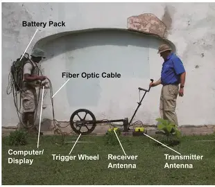
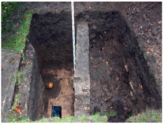
Ponary: The German army occupied Vilnius on June 24, 1941. The following month, German mobile killing units called Einsatzgruppen, and their Lithuanian auxiliaries, murdered thousands of Jewish residents of Vilnius at a killing site in the Ponary (Paneriai) Forest, southwest of Vilnius. By the end of 1941, Einsatzgruppen had killed about 40,000 Jews in Ponary. By July 1944, as many as 75,000 people had been killed at the site, the vast majority of them Jews. We worked at the site using GPR and ERT to document various events that occurred at Ponary, including the atrocities that were perpetrated by Nazi Germany, and the escape tunnel that was dug by Jews imprisoned at the site who were charged with digging up and then burning the bodies. The story of our research and Ponar is told in the PBS NOVA film “Holocaust Escape Tunnel.”
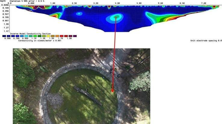
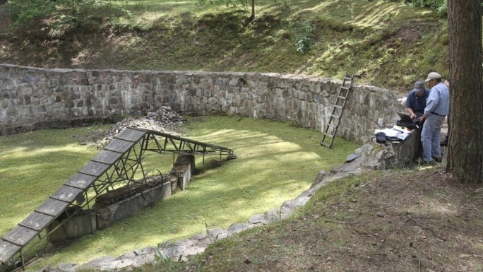
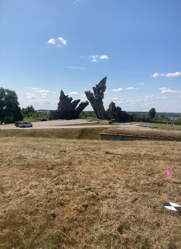
Fort IX: The Ninth Fort in Kaunas, is a 19th-century defensive fortification that the Nazis and their local collaborators utilized as a primary execution site during the Holocaust. Between 1941 and 1944, approximately 50,000 people—including over 30,000 Jews from Lithuania and across Europe—were murdered there. We used GPR and ERT to gather additional information about the mass burial area adjacent to the fort.
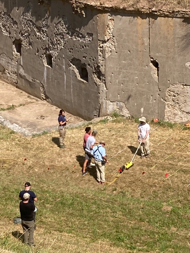
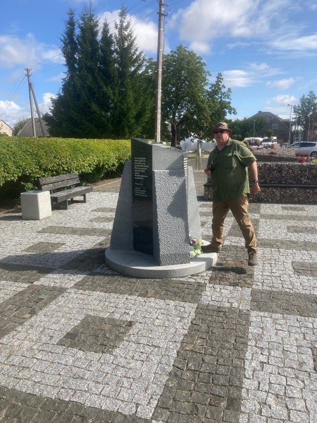
Seduva: On June 25th 1941, the Nazis occupied Šeduva, and at the beginning of July, the Jews of the town were forcibly evicted from their homes and driven to the neighboring village of Pavartyčiai, where a ghetto was established. On August 25th and 26th, 27 of the captured Jews, including the last rabbi of Šeduva, Mordechai David Henkin, were shot in Pakuteniai forest about eight kilometers south of Seduva, and approximately 700 Jews were shot in Liaudiškiai Forest. We collected GPR data at three sites in the forest, as well as the Jewish Cemetery in the town of Seduva, to add new information to the knowledge base about the atrocities that occurred in Seduva and the surrounding area.
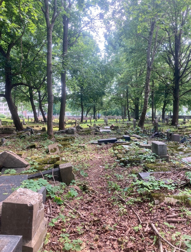
Kaunas Jewish Cemetery in Zaliakalnis: Nazi Germany occupied Kaunas, from June 1941 to July 1944. Assisted by parts of the local non-Jewish population, the Germans massacred thousands of Jews within weeks of arriving in the city. They forced the surviving Jews into a ghetto and, later, created a concentration camp. The Germans gradually deported and mass murdered Kaunas’s Jewish community. Of the 30,000 people imprisoned in the Kaunas ghetto, only around 2,500 survived the war. It was a common practice used by the Germans and their collaborators, to use existing Jewish cemeteries as places for mass burial. The Kaunas Jewish Cemetery was one such place. Testimony indicates that on June 27th 1941 Lithuanian, and possibly some German perpetrators forced dozens of Jews to a garage courtyard in the city center. The courtyard was located outside an administrative building that belonged to Lietukis, a large nationwide union of agricultural cooperatives. In the courtyard, the Jews were publicly tortured and beaten to death in front of a crowd of spectators. They were then reportedly buried in a mass grave in the Kaunas Jewish Cemetery. The use of Jewish cemeteries as places of mass burial is the topic of the article “Using Geophysics to Locate Holocaust Era Mass Graves in Jewish Cemeteries: Examples from Latvia and Lithuania.” This article also addresses to same topic for the Old Jewish Cemetery in Riga, Latvia, and the Jewish section of Livas Cemetery in Liepaja, Latvia.
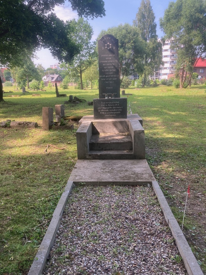
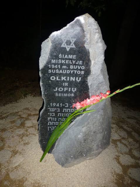
Matilda Olkin Burial Site: Matilda Olkinaitė (also known as Matilda Olkin), the renowned young Lithuanian-Jewish poet, and her family were murdered on July 10, 1941. They are buried in a previously unmarked mass grave in the Kavoliškis forest (near the Sachara peat bog), located in the Rokiškis district of northeastern Lithuania. Using GPR we discovered this grave in 2018, and it became the topic of a special feature article in Smithsonian Magazine titled “The Words of a Young Jewish Poet Provoke Soul-Searching in Lithuania.” The story of Matilda Olkin was also the subject of a 2021 student documentary film titled “Finding Matilda.”
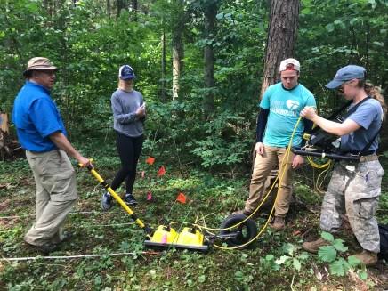
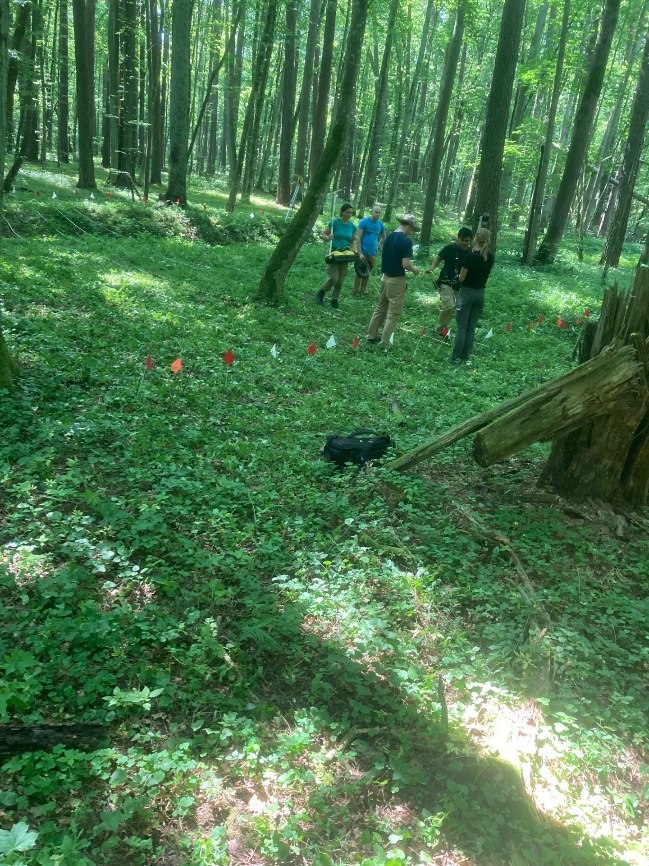
Alytus (the Vidzgiris Forest): The Holocaust in Alytus involved the destruction of one of Lithuania's oldest Jewish communities. Between August and September 1941, German occupation forces and Lithuanian collaborators murdered roughly 1,300 local and regional Jews in the nearby Vidzgiris Forest. Located about 1 km south of the city, this site contains a memorial ensemble unveiled in 1993. It features a large "broken" Star of David, nine pyramids marking the mass graves, and an obelisk. In 2023 research was completed in the Vidzgiris Forest using GPR to verify that the memorials indeed marked the location of mass graves, and to determine if additional mass graves could be located in the forest. The results of this research were partially reported in the BBC Two documentary “How the Holocaust Began” and the National Geographic documentary “The Hidden Holocaust” and in the article “A Non-Destructive Search for Holocaust-Era Mass Graves Using Ground Penetrating Radar in the Vidzgiris Forest, Alytus, Lithuania.”
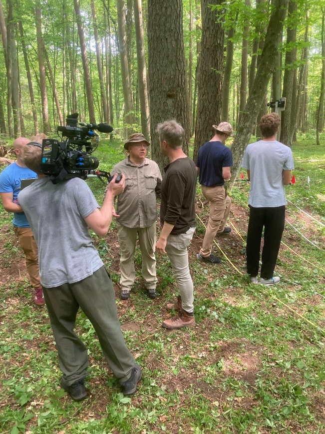
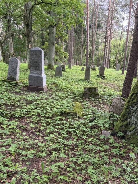
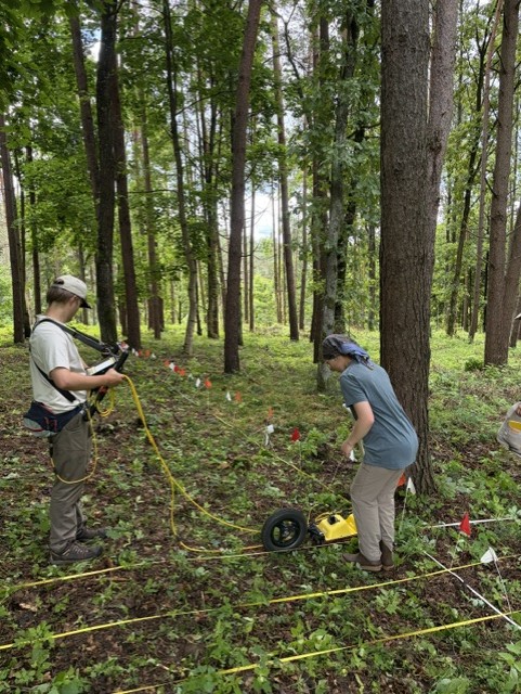
Old Jewish Cemetery (Vilkija): The Jewish community settled in Vilkija at the end of the 18th century. At the end of the 19th century, Vilkija’s Jewish population numbered 1,431, which constituted 71 percent of the town’s total population. However, by the 1930s, the Jewish population sharply declined, and by 1940, only about 500 Jews remained in Vilkija, making up just 25 percent of the total population. On the eve of World War II, about 400 Jews resided in the town. The darkest chapter in Vilkija’s Jewish history began in June 1941, when German forces occupied the village during World War II. In late August 1941, the Jews were taken to a nearby forest and brutally murdered by the Nazis and their Lithuanian collaborators. This mass execution marked the near-total destruction of Vilkija’s Jewish population, and in the context of the Jewish cemetery, traditional burial, and maintenance of the cemetery ceased. Working with Rabbi Eichonon Baron, the director of the Society for the Preservation and Promotion of Jewish Heritage in Lithuania, in 2024 and again in 2026, we attempted to locate the boundaries of the cemetery, and areas where there were buried headstones existed within the cemetery. This work will continue in consultation with Rabbi Barron.
Latvia
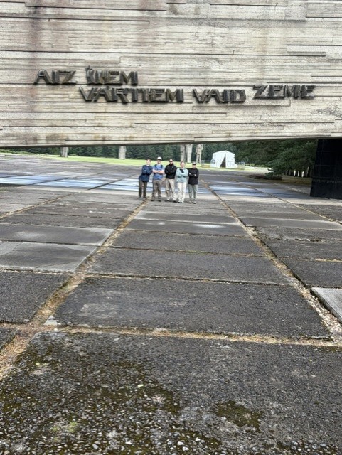
Salispils Camp: The Salaspils camp near Riga, which was operated during the Nazi occupation of Latvia, has long been the subject of controversy. Around 23,000 people were imprisoned there, half of which were political prisoners, labor resisters and convicted soldiers, the rest were prisoners from special operations against civilians in Belarus, Russia and the Latgale region of Latvia. The death toll in the camp, including the number of Jews who died during construction, is well over 3,000 people. Jewish forced laborers from the Jungfernhof camp (discussed later in this website) were taken to begin constructing the Salaspils concentration camp in late 1941 and January 1942. They were forced to clear the heavily wooded site and build their own rudimentary barracks in the freezing winter conditions. Construction continued through the harsh winter, with at least 1,000 additional Jews from the Riga Ghetto were brought in by mid-January 1942. Most of the surviving Jewish laborers were sent back to the Riga Ghetto or killed when the initial camp construction was completed in the spring of 1942. The Nazis used the Old Garrison Cemetery near the camp to secretly bury and conceal the bodies of prisoners. Excavations have revealed mass graves layered with the corpses of hundreds of young children. We conducted GPR research near the Garrison Cemetery as part of an effort to look for additional mass burials just outside the boundary of the cemetery. Thus far no mass burials have been located.
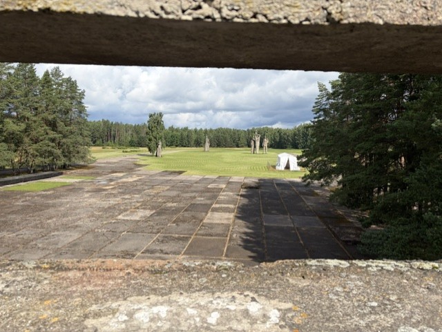
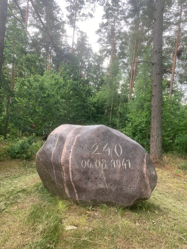
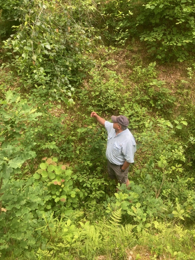
Sabile: Nazi troops entered Sabile on July 1, 1941, and actions against Jews began immediately. The synagogue was burned down, and all the Jews were placed in one building. On August 6, 1941, the Nazis and local auxiliaries marched the town's entire Jewish population, 240 men, women, and children—into the forest and shot them. Just a few days later, the town’s Roma population was also rounded up and brought to the forest to be executed, with a mass grave already dug. They were saved at the last minute when the local town mayor, Mārtiņš Bērziņš, intervened and rode his bicycle to the execution site with orders to postpone the killing. So, the Sabile execution site is comprised of a mass grave that contains the remains of 240 Jews, and an open pit that was intended to contain the remains of the town's Roma population. We collected GPR data at the mass grave site in order to chronicle GPR reflection patterns at a known mass grave. This data will serve as an important reference for future research at suspected mass graves.
The Old Jewish Cemetery (Riga):
The Old Jewish Cemetery at 2/4 Līksnas Street was included in the territory of the Riga Ghetto, which was established in 1941. While the ghetto existed, Jews, who had been executed, committed suicide or had been murdered in the Ghetto during Rumbula actions (November 30th and December 8th 1941) were buried in mass graves in the Old Jewish Cemetery. The total number of victims buried in the cemetery is estimated to be 2,000. After World War II most of the tombstones were stolen, and the high brick walls that surrounded the cemetery were demolished by the Office of Renovations and Construction of Riga City Moscow District and the property was transformed into the Park of Communist Brigades in 1960. We completed research in the cemetery in an attempt to locate the mass graves. The previously mentioned article “Using Geophysics to Locate Holocaust Era Mass Graves in Jewish Cemeteries: Examples from Latvia and Lithuania” discusses details about this search for mass graves in the Riga Old Jewish Cemetery.
Detailed Discussion of Research at the Jungfernhof Concentration Camp Site, Skede, Liepaja Port and Lighthouse, and the Jewish Section of the Livas Cemetery
In 2025 and 2026, thanks to the generous support of the Conference on Jewish Material Claims Against Germany, supported by the German Federal Ministry of Finance, the International Holocaust Remembrance Alliance (IHRA), and the Uniting Foundation (Latvia), comprehensive research was conducted at the site of the Jungfernhof Concentration Camp in Riga, Skede (near Liepaja), the Lighthouse at the Port of Liepaja, and the Jewish section of Livas Jewish Cemetery in Liepaja. Each of these sites is discussed in detail.
Jungfernhof Concentration Camp
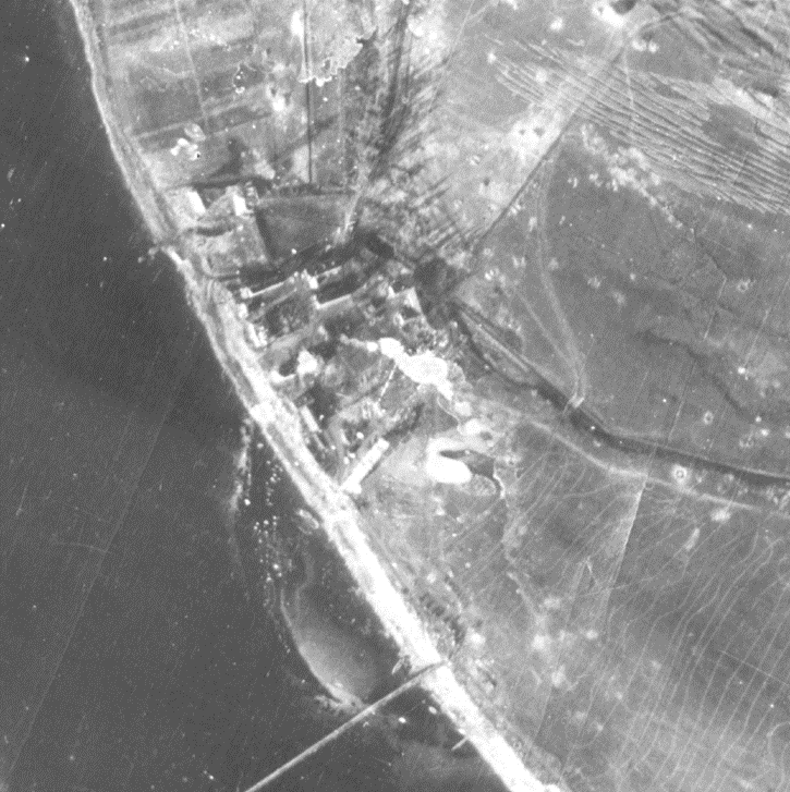
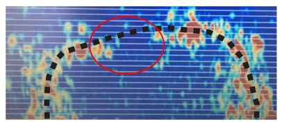
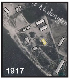
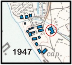
To understand and interpret the context of the Jungfernhof Concentration Camp using geophysics, mapping and spatial analysis techniques, it is important to know the history of the area. Today only a few remnants of the last major usage of the area, the concentration camp, remain. The site of the camp is located 1 ½ kilometers south of the Šķirotava freight (rail) yard, and about 12 kilometers from the Riga City Center, on the Daugava River.
Parallel History of the Holocaust by Bullets and Jungfernhof Concentration Camp: When asked when the Holocaust by Bullets began, it is usually answered that it was before the Wannsee Conference in Berlin in January 1942. At this conference the final solution of the Jewish question was determined to be the systematic death of Jews by coordinated actions. There were steps that the Nazis went through to ensure that the early killing of the Jews would be part of a coordinated propaganda effort to portray the Jews in negative stereotypes. The Jungfernhof Concentration Camp is a unique and significant example of how the Holocaust by Bullets was begun in many ways.
The improvised concentration camp Jungfernhof, in operation from December 1941 through March 1942, was set up at the Mazjumprava Manor (Little Jumpravmuiza). The camp served as overflow housing for Jews from Germany and Austria, who had originally been intended to stay in Minsk, but who were moved to Riga instead. The Riga Ghetto was overcrowded and could not accommodate these deported Jews, so when the first transport train with 1,053 Berlin Jews arrived at the Šķirotava Railway Station on November 30, 1941, all persons on board were murdered that same day. Jews from transports 2 to 5 were housed at Jungfernhof, and when the sixth transport arrived on December 10, 1941, with Jews from Cologne, Germany, these Jews were housed in the newly "freed up" Riga Ghetto, where space was now available because Jews from the ghetto had recently been killed at Rumbula and in the Bikernieku Forest.
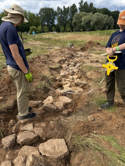
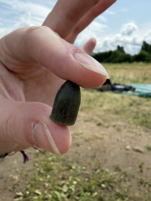
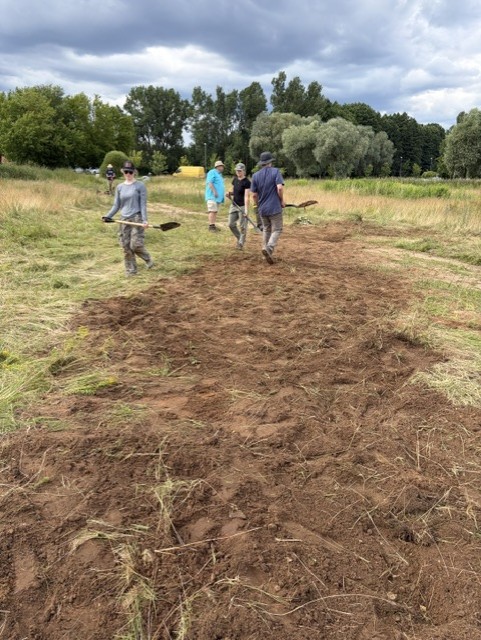
Project Outreach:
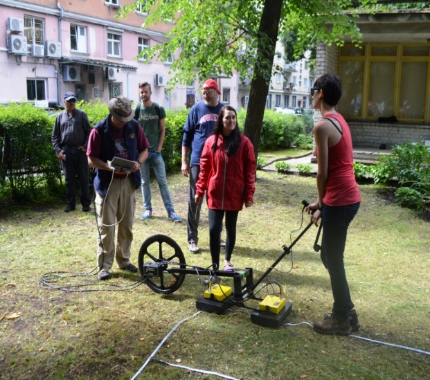
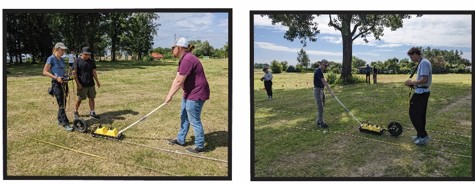
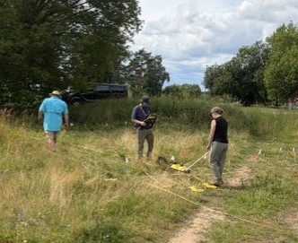
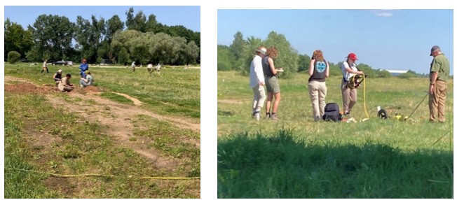
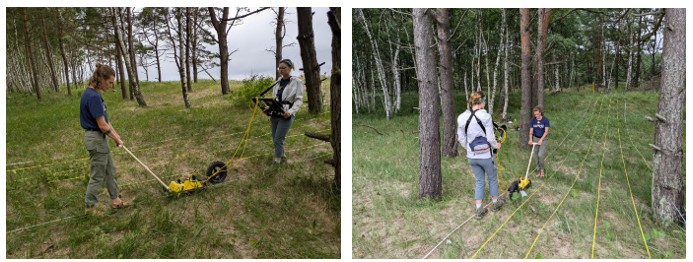
A component of our research also includes involving local communities whenever possible in aspects of our research. What occurred in the Holocaust can be somewhat abstract to local, non-Jewish populations, especially younger generations. Through our research we often reach out to this younger generation. This takes place in several ways, one of which is to include US undergraduate students in our research. At Jungfernhof, over 30 US students have participated in the research between 2022 and 2026. We also seek out ways to interact with Latvian students, especially the younger generation. Below are photographs from Jungfernhof that were taken on July 8, 2025. We incorporated students from a local summer camp (ages 10 to 14) into the soil probing and data collection processes that were being completed at the site that day. The students were trained on proper soil collection techniques, and with US based undergraduate students serving as mentors, the Latvian students analyzed the physical characteristics of the soil, and looked for any anthropogenic inclusions. By having the Latvian students participate in this endeavor, we feel that we are not only involving the students in the processes of completing scientific research, but we are also exposing them to important concepts about the Holocaust. This aspect of our research will continue as long as we are still working on this project at Jungfernhof and other locations in Latvia.
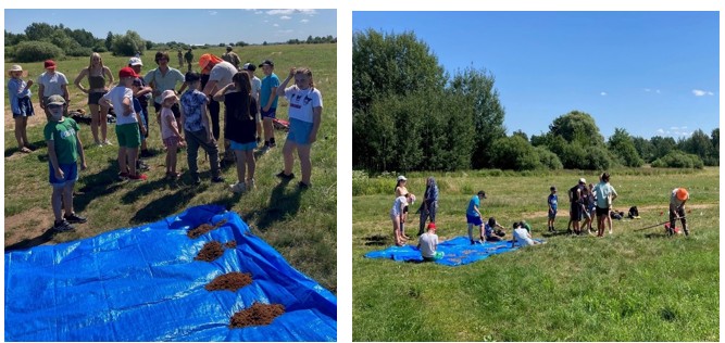
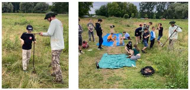
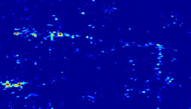
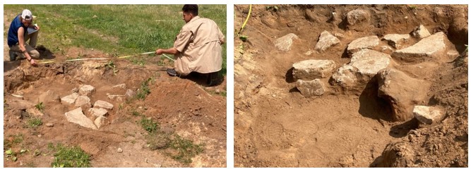
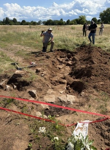
Research will continue at the site of the Jungfernhof Concentration Camp. Future research plans include finding the location of and uncovering more of the buried remains of the prisoner barracks foundation. We will also continue to search for a mass grave at the site that contains the remains of approximately 800 prisoners that died during the Winter of 1941-1942. This webpage will continue to be updated based on discoveries related to this ongoing research at the Jungfernhof Concentration Camp Site.
Skede
The area around Liepaja, Latvia, is known for several atrocities associated with the Holocaust. German troops occupied Liepaja beginning on June 29th, 1941. At that time, approximately 7,000 Jews lived in Liepaja. Very quickly after the arrival of Nazi Germany’s troops Jews were arrested, murdered, and buried at Rainis Park and the port, both of which are within the confines of the Liepaja municipal limits. By the end of July, 1941, almost 1,000 Jewish men had been murdered. In August, the executions were fewer and more random. In September and October, the murder rate increased, and by November, approximately 3,900 Jews remained in Liepaja, primarily women, and children. The most extensive action against Jews in Liepaja began in September 1941, when several hundred Jews were shot at the Skede dunes 15 kilometers north of Liepaja. In December 1941, Latvian police arrested thousands of Jews in Liepaja and brought them to Skede. A long trench was prepared in the dunes for their murder and burial. The Jews, mostly the remaining women and children, were forced to strip off their clothing at various points on their journey to the trench and were executed by detachments of the Einsatzgruppen (mobile killing units), the Sicherheitsdienst (SD), the Ordnungspolizei (ORPO), and Latvian auxiliary police and volunteers from the "Arajs Kommando" militia force.
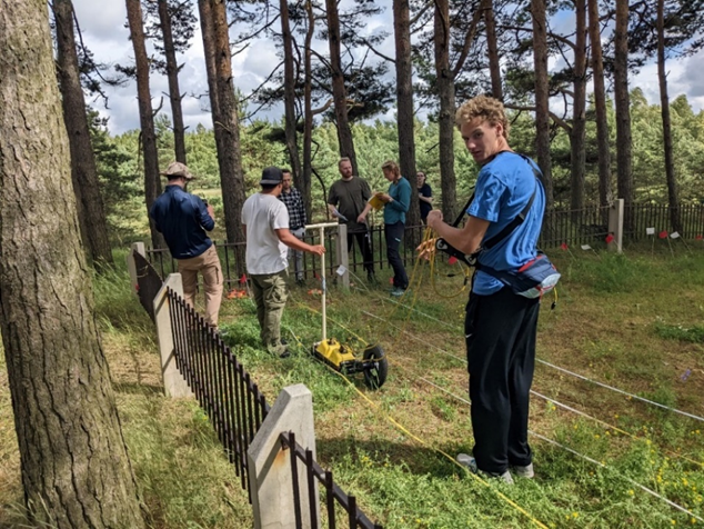
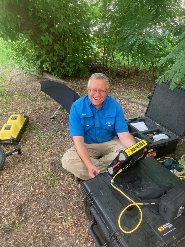
…. GPR data was collected in the vicinity of the Soviet-era monument constructed in the area. The GPR acquisition system used to collect data was a Sensors and Software pulseEKKO™. The GPR profiles were collected with 500-Megahertz (MHz) antennae, and a separation of 0.5 meters, and a step size of 0.02 meters, were used to provide good horizontal resolution.
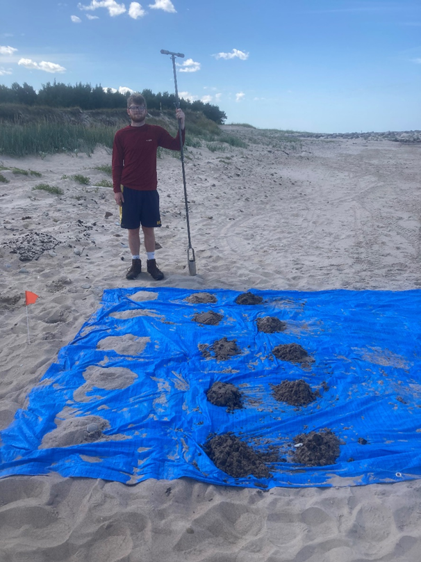
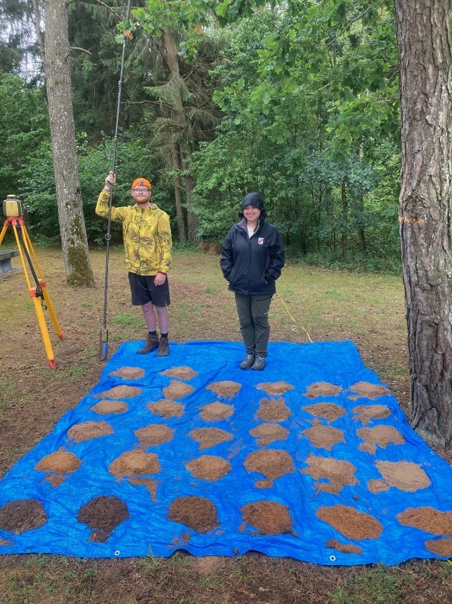
Samples were collected from the “Beach Soil Probe” site adjacent to the Skede dunes. The lower left sample is from 0 (surface) to 10 cm, and the upper right sample is from 140 to 150 centimeters below the surface. The purpose of collecting and then analyzing these samples was to determine the natural characteristics of the soil/sediments (hereafter soils) to determine how these samples varied with depth and spatially. Based upon these basic interpretations, comparisons could be made between sample depth and location, and similarities and differences were then quantified for each location. Each sample was also painstakingly evaluated in the field for the presence of any special features, that included the presence of coarse fragments (larger pieces of geologic material) in a matrix of smaller (sand-sized) material. The presence of coarse fragments allows some geomorphic and depositional parameters to be evaluated. Anomalous features, like rapid changes in color, texture and/or other soil physical properties were also noted, as were the presence of other anomalous features like bone/bone fragments, building materials, and materials that may be anthropogenic (derived through human activity).
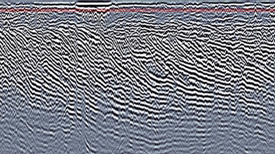
This cross-sectional data was collected from a depth of 0.85 to 0.90 meters below the land surface in the Skede dunes. The patterns that are present are features related to the natural system of dunes that exist in the Skede area at the interface between the land and Baltic Sea. The inclined (tilted) beds are clearly seen across the entire 40-meter expanse of the cross section. Inclined layers in dunes are referred to as cross-bedding and these inclined layers form when wind and/or water currents move sediment from one slope of a dune to another over time. These cross beds form when sediment is eroded from the up-current (or up-wind) slope of a dune, and then that sediment is then deposited on the down-current (down-wind slope). The sediment is deposited as these cross beds through processes termed grain flow and grain fall. Through these processes cross beds become inclined in relation to the horizontal layering of a typical sedimentary deposit. These cross-bedded materials show absolutely no evidence of human disturbance.
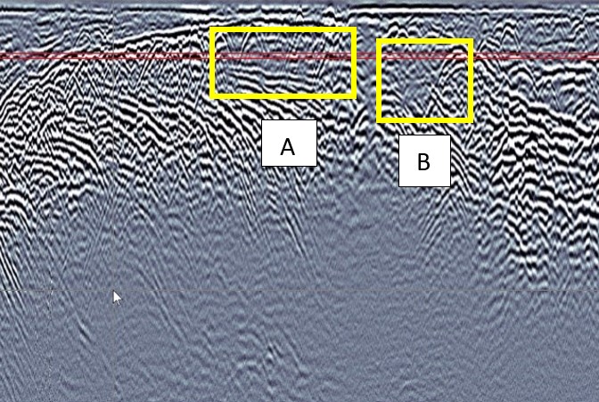
In the cross-section view above there are definite patterns, which in our opinion, may be related to human disturbance, possibly associated with the Holocaust. What is striking about the cross-section are the areas that are highlighted by the yellow boxes. Box “A” is an area of disturbed strata (layers) above an area of intact soil layers. Box “B” is an area of inclined layers where the strata are essentially truncated over an area of three meters (from 19 to 22 meters) along the x-axis of the cross-section. The patterns highlighted in the cross-section, in our opinion may be associated with mass burial trenches in the Skede dunes.
Numerous GPR grids have been completed during the various phases of research in the Skede dunes. Many of the grids after analysis and interpretation, did not contain reflection patterns that could be linked with anthropogenic activities associated with the Holocaust. Some interesting geomorphic trends were established from the data collected in some of the grids, providing a clear indication that these areas of the Skede dunes were not disturbed by human activities, which includes the creation of mass graves. Cross bedding was clear in several of the grids, and with the presence of these features, a type section can be developed for the natural geomorphic signature for the Skede dunes. That natural signature, as seen via GPR, can be compared with other GPR slice and cross-section data to determine if anomalies are present that can be linked to events associated with the Holocaust. Important data was also collected related to the coastal geomorphology. Compilation of this data base is important in the context of determining if the mass graves along the Skede coastline washed out to sea, or if they are still present along the coastline. All of these components of the research will continue as part of future research endeavors in Skede.
Research will continue in the Skede Dunes area. Future research plans include a more focused approach in the area north of the Soviet-era monument, extending from the monument for approximately 200 meters. Preliminary data from 2026 indicates a great deal of disturbance in the soils in the areas north of the monument. At this point we are unsure whether the disturbances, which we believe are anthropogenic, correlate with the mass grave at Skede that contains the remains of the 2,800 women and children that were murdered and buried in a mass grave in December 1941. This webpage will continue to be updated based on discoveries related to this ongoing research at Skede.
Livas Jewish Cemetery
Liepaja, is located in the Courland region of Latvia. It is a port city directly adjacent to the Baltic Sea. A Jewish community was established in Liepaja in the early 1800s, and by the end of the 19th century there were approximately 9,400 Jews living in Liepaja, which was about 14% of the city's population at that time. On June 29, 1941, the Germans occupied Liepaja and began carrying out political arrests and murders with the collaboration of the Latvian "Self-Defense" organization. The first murder operation took place on the first day of occupation, when the Einsaztkommando (a sub-group of the Einsatzgruppen (mobile killing squads) whose mission was to exterminate Jews, shot and buried a group of Jews, along with Latvian activists, in Soviet dug anti-tank ditches (trenches) in Rainis Park in the north part of the city. Two to three weeks later, when the stench from the park had become overwhelming because the layer of earth covering the corpses was too thin, the Germans ordered Jewish residents to exhume the bodies, transport them in wagons and rebury them in a mass grave dug in the Jewish section of the Livas Cemetery on the south side of the city. Estimates of the total number of victims varies from several dozen to up to 300. These activities marked an end to the murders and burials associated with Rainis Park. Beginning on July 7, 1941 the dunes in the vicinity of the port and the Liepaja Lighthouse were used for the murder and burial of Jews. The main focus of our research was to use GPR to assist with determining the location of this mass grave in Livas Cemetery.
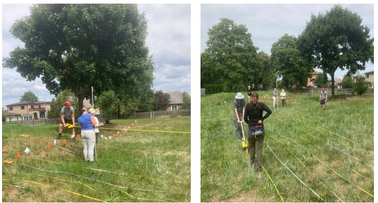
These photos depict the process of creating a grid and collecting topographic data from that grid which was placed near a prominent mound in an obviously disturbed area of the cemetery that is devoid of gravestones. Based on the visual appearance of this area it was speculated that this may be the location of the mass grave.
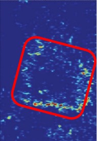
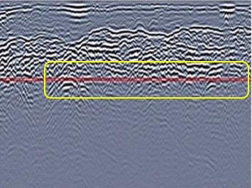
The top image above is a data slice from 1.60 to 1.65 meters below the surface, and the corresponding cross-section for the grid is below this slice data. The data slice shows reflection patterns that possess right angle bends at this depth. The double red line extending across the cross-section clearly passes through disturbed areas, as indicated by the discontinuous and inclined layers and the presence of hyperbolic reflections.
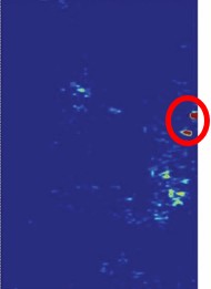
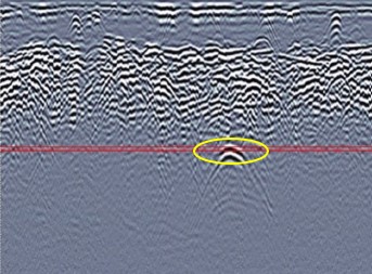
This data slice and cross-section (as indicated by the double red line on the cross-section) is from 2.15 to 2.20 meters below the surface. The data slice indicates that the reflection patterns that were very clear between 1.60 and 1.65 meters, has diminished with depth, probably indicting that this is the bottom of that feature. The double red line extending across the cross-section does appear to intersect one small anomalous feature, which is highlighted on the slice and cross-section. The nature of this feature has not yet been determined.
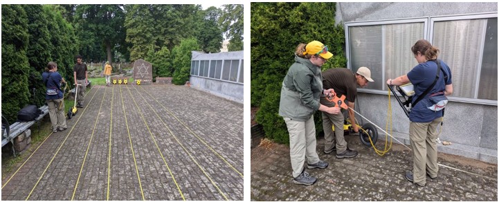
GPR data was also collected near the Star of David Memorial in the cemetery to determine if the memorial wall was constructed near the mass grave of the victims from Rainis Park. No reflection patterns were present, indicating that the mass grave of the victims of the Rainis Park massacre is not located in this area.
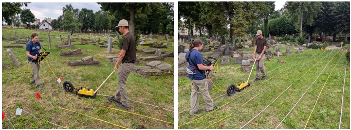
An 18.5 x 4-meter grid was created near the memorial wall in an area devoid of headstones, which was directly adjacent to areas in the cemetery that contained headstones. This grid’s placement was intended to determine if single burials were present in this area, but the headstones had been removed. Based on the interpretation of the collected GPR data, no reflection patterns were present that indicated the presence of individual graves.
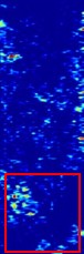
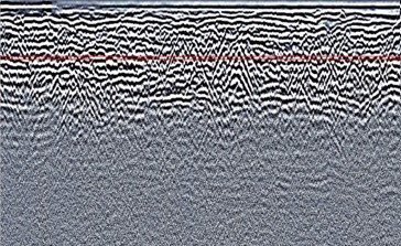
This slice and cross-section data is from a depth of 0.95 to 1.0 meters beneath the surface in the area overlain by the memorial. At this depth there are reflection patterns in the lower quadrant of the slice data contained within the red box. At this depth of 1 meter beneath the land surface one would not expect any disturbance associated with the construction of the memorial to have penetrated this deep beneath the land surface. Therefore, it is possible that the features found at this depth may be associated with other human activity. It is still too early in the data interpretation process to clearly state that these features are associated with mass burial activities. In the cross section several hyperbolas are present where the depth line crosses the cross-section.

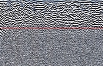
The data depicted in this slice is from a depth of 1.70 to 1.75 meters beneath the land surface. At this depth reflection patterns that were present at 1.0 meters are not visible in this slice data, indicating that the feature found at 1.0 meters beneath the surface does not extend to a depth of 1.70 meters. This does not invalidate the fact that there are reflection patterns present at 1.0 meters, that may be associated with human activities. At this point in time, it is still too early in the data interpretation process to clearly state that these features are or are not associated with burial activities.
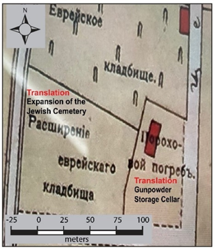
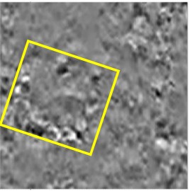
An important discovery related to this research was made in summer 2025 by an associate of the Liepaja Jewish Heritage Foundation in the Liepaja Museum. A map depicting Liepaja in 1903 was discovered that provides important details about the Livas Cemetery. The map highlights the location of four buildings (two are shown on the map above), with the buildings indicated on this map as red rectangles. The text on the map, near one of the buildings, in Russian says “Gunpowder storage cellar.” An Impulse Radar image collected in summer 2025 shows a reflection pattern (within the yellow square), that very likely correlates with this storage cellar/bunker. It is therefore probably not associated with a mass grave in the cemetery.
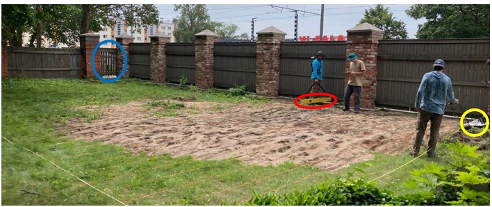
Additionally, in 2025, an 8 x 16-meter grid was placed in the southwestern corner of the Livas Cemetery. This part of the cemetery was of particular interest because of its proximity to a former gate into the cemetery. The location of this gate is highlighted (blue circle) in the photo below, which depicts data collection using the EM38-4 (red circle) and Impulse Radar (yellow circle).
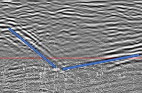
A cross-section of the GPR data collected 1.3 meters below the surface from this grid in 2025 possesses a reflection pattern that contains two areas of what appears to be inclined layers, which are indicated by the blue arrows added to the cross-section. The controlling factors behind the presence of these features is not yet known, and additional data processing and interpretation is required to further assess these reflection patterns. Furthermore, additional GPR data will be collected from this location in summer 2026 using the Sensors and Software GPR system.
Research will continue in the Jewish Section of the Livas Cemetery. Future research plans include continued imaging of the remains of a buried structure that was located using GPR near the east entrance to the cemetery. Historic documents indicate that this building may have been the structure wherein bodies were prepared for a traditional Jewish burial. Additionally, based on the 1903 historic map that was discovered, the feature originally thought to be the possible mass burial site for the victims of the Rainis Park massacre, is in reality the remains of a pre-World War I gunpowder storage bunker. Hence, the location of this mass grave remains unknown, and future research will continue to focus on locating this historically important feature. This webpage will continue to be updated based on discoveries related to this ongoing research at Livas Cemetery.
Liepaja Port and Lighthouse
Similar to the Jungfernhof Concentration Camp and Livas Cemetery sites, actions by Nazi Germany and local collaborators are responsible for the murder and mass burial of Jews at the port and lighthouse area in Liepaja. These murders are infamous, and remain visually etched in history because they were filmed by a German soldier who “happened by” with a movie camera. The soldier’s name was Reinhard Wiener, and the film images he captured that day (hereafter referred to as the Wiener film) show graphic images of men being shot and killed in a prepared burial trench in the dunes near the Liepaja Lighthouse.
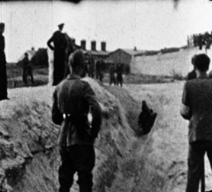
In this still frame image extracted from the Wiener film, the trench can be seen, with several Jewish men in the trench, in the act of being shot and killed. In the area behind the trench, the wall of a late 19th century fortress can be seen, as well as the smoke stacks from a fish processing (smoking) factory. These features provide visual benchmarks that can be used to match this location to the modern day setting of the site where these atrocities occurred, and to be part of the process of locating the position of this feature on the modern-day landscape.
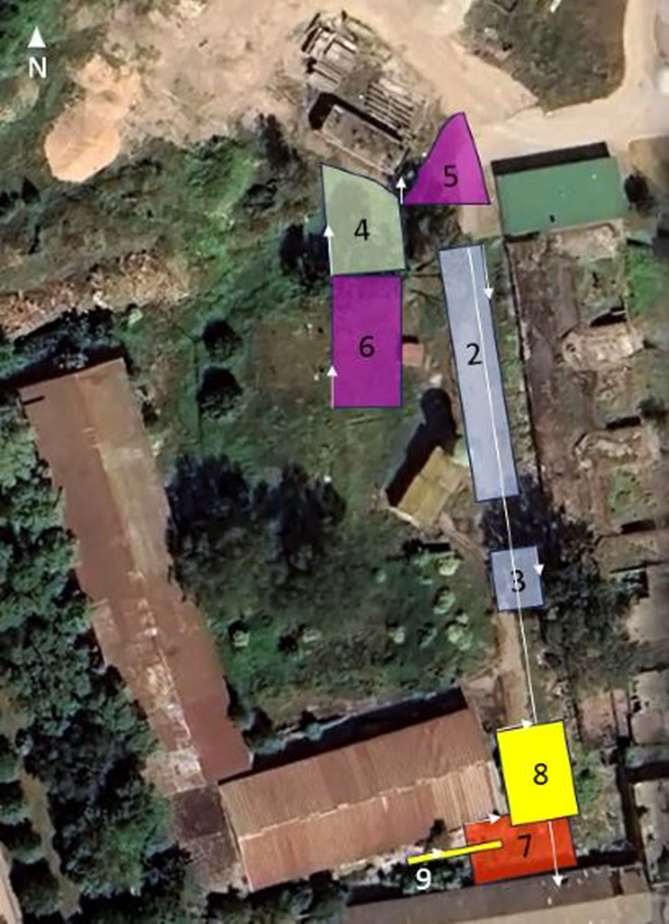
Over several years, data was collected from nine GPR grids of various sizes. Grid 2 is directly related to the search for the burial trench that is depicted in the Wiener film. GPR data was collected from this grid initially in 2022, and based on the interpretation of that data, additional data was collected in 2024 and 2025.
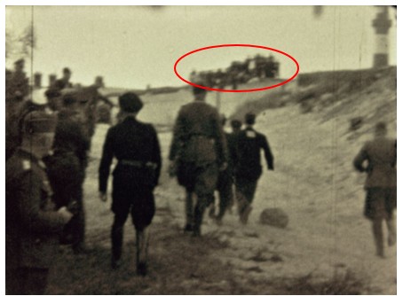
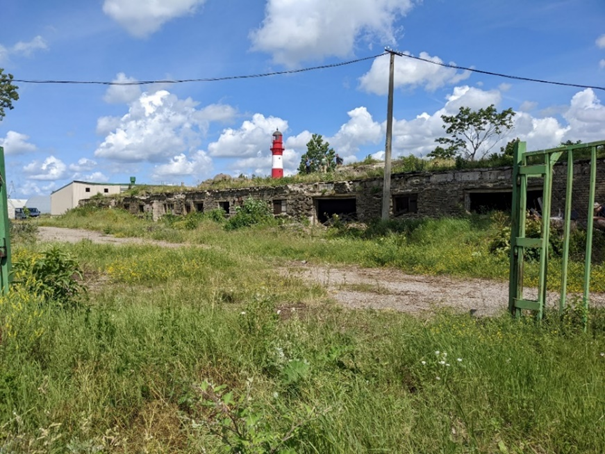
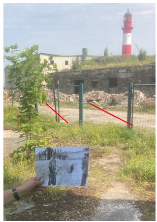
To further facilitate the positioning of GPR grid 2 in 2022, a visual comparison was completed using a grainy still photograph extracted from the Wiener film which depicts Jewish men being hurried to the trench to be shot, while spectators view these atrocities (within the red oval), and a photo taken from the same perspective in summer 2022. The location of the lighthouse is used as a reference point to visually align these images, and thus make a best approximation of the murder/burial trenches location.
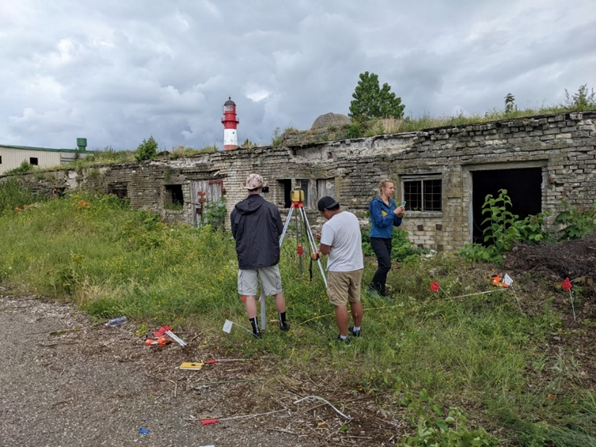
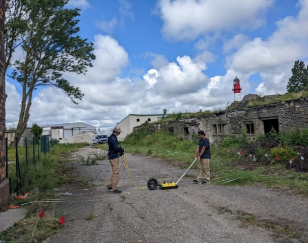
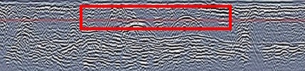
Based on the GPR and topography data collected in 2022, 2023 and 2025, the location of the burial trench depicted in the Wiener film was confirmed. GPR grid 2 from 2022 was recreated at that same location in 2023 to further corroborate the presence and nature of the reflection pattern found in 2022. The subsurface signatures are virtually identical when comparing the 2022 and 2023 GPR slice data from 1.7 meters below the surface. The two slanted reflection patterns that transect the data slice indicate the sides of the trench. In the cross-section the red rectangle highlights two rounded hyperbolas that indicate the two sides of the burial trench.

A still photo extracted from the Wiener film, being held at a location on the modern land surface near the 19th century fortification, at the same orientation as the anomaly detected in the GPR data, further establishes the relationship between the GPR data and the trench’s location. The position of the anomaly on the modern land surface is shown by the two parallel red lines on the photograph.
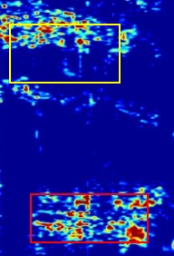
GPR grids 7, 8 and 9 are in the vicinity of an area noted as a “Murder Site” on a map created as part of a 1945 Soviet Commission report that chronicled atrocities by Nazi Germany. Reflection patterns associated with slice data from grid 7 indicates the presence of two possible mass graves at this location. Their locations are indicated on the slice from 1.60 meters below the land surface by the yellow and red rectangles. The location of these reflection patterns on the cross-section are highlighted by similar rectangles. The burial trenches associated with the “Murder Site,” as depicted on the 1945 Soviet Commission map, are oriented more or less north and south. The reflection patterns in the slice and cross-section views are oriented north and south, which is the same orientation as the trenches in the 1945 map. These features are therefore associated with the upper portion of these burial trenches.
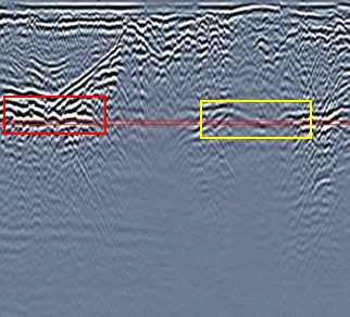
Slice data from grid 8, from a depth of 1.0 meters below the land surface indicates two strong reflection patterns. These same reflection patterns are seen in the matching cross-section. Similar to the reflection patterns in grid 7, the reflection patterns in grid 8, highlighted by the red rectangle in the slice and cross-section views, are oriented more or less north and south, which is again the same orientation as the trenches on the 1945 map. These reflection patterns very likely represent the loction of mass graves from the Holocaust.
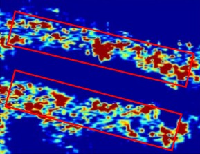
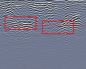
Based on the analysis and interpretation of the data collected from GPR grids 7 and 8, the reflection patterns are associated with four of the mass graves depicted on the 1945 Soviet Commission map. These features are consistently about 4 meters wide in the data slice view and they consistently first appear at a depth of 1.0 meters below the land surface, and the intensity of the reflection patterns increase markedly with depth at 1.5 meters. They diminish with depth at 1.7 meters, and are barely visible at a depth of 2.75 meters. Based upon these interpretations, the bottom of the trenches are at a depth of about 2.50 to 2.75 meters below the surface. Given the dimensions of these feature, their orientation, depth, and location (as compared to the location of the “Murder Site”) these reflection patterns mark the location of four of the five burial trenches noted on the 1945 Soviet Commission map.
The data collection portion for the research at the Port and Lighthouse area has been completed, and there are no future plans for additional data collection at this location. Previously collected data still requires additional processing and new discoveries may still be made based upon the continued analysis and interpretation of this data. Based on previous data analysis and interpretation, we are very confident that we have found the location of the mass burial depicted in the Wiener film, as well as three, and possibly four, of the mass graves depicted on the 1945 Soviet Commission map. These data will continue to be analyzed, and based upon this further analysis even more new information may be added to the existing knowledge base about the atrocities that occurred at this place. This webpage will continue to be updated based on discoveries related to this ongoing analysis of data from the Port and Lighthouse area in Liepaja.
Summation
Holocaust-related research completed since 2015 is outlined in this webpage. This includes five sites in Poland, ten in Lithuania, and eight in Latvia. In recent years, research has focused on the Jungfernhof Concentration Camp, Skede, the Jewish Section of the Livas Cemetery, and the Port and Lighthouse area in Liepaja sites, all of which are located in Latvia. The research for these four sites is presented in more detail. As noted, the data collection process at the Port and Lighthouse area is complete, and we will not return to that location in summer 2027. Planning is underway to return the Jungfernhof, Skede, and the Jewish section of Livas Cemetery sites. Also, preliminary data was collected in summer 2026 at a site in Švenčionys, Lithuania, and planning is underway to return to this site. The intent of this research is to locate the buried remains of three synagogues that were once located in what is now the Švenčionys City Park. The data collected for this site in summer 2026 is being processed, and the results are being interpreted. Information for this site will be part of future updates to this webpage. We are also exploring options for adding new locations to the roster of study sites in 2027.
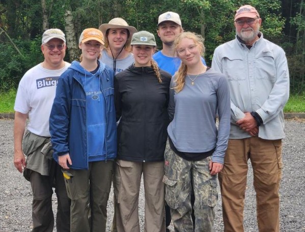
In closing, this body of research would not have been possible without our in-country research partners, the organizations that provided grant funding, the ever-changing roster of undergraduate students, and the co-investigators that participated in this research. Thanks to our research partners, which includes the Museum of the Jews in Latvia, the Uniting Foundation, and the Liepaja Jewish Heritage Foundation. Additionally, thank you to the Conference on Jewish Material Claims Against Germany, supported by the German Federal Ministry of Finance, the International Holocaust Remembrance Alliance (IHRA), and the Uniting Foundation which have in recent years provided funding to support this research. In 2026, five undergraduate students from the University of Wisconsin-Eau Claire (UWEC) participated in the research, along with Professor Harry Jol and Geospatial Technology Facilitator Martin Goettl from UWEC.
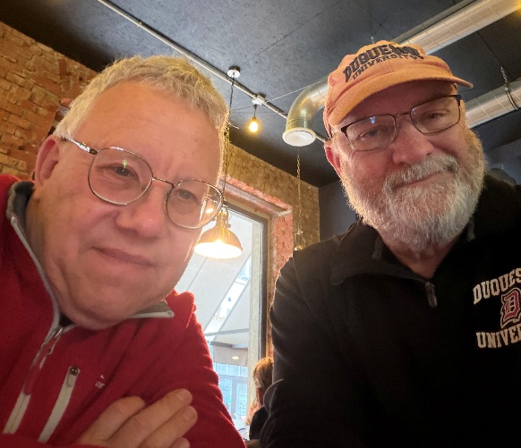
Dr. Jol and I have been conducting research together for the past 28 years, starting with the Cave of Letters Project in the Judean Desert in Israel in 1999.
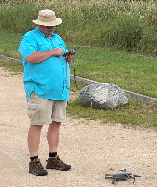
In closing, I want to pay tribute to the guiding force behind the research presented in this webpage. Professor/Rabbi Richard A. Freund is the inspiration behind this research, as well as a book I edited, that was published in 2023. I knew Richard for 24 years, and we spent many hours together chasing our shared passions of teaching, providing students with experiential learning opportunities, and pursuing meaningful research. When we first met in 1998, this first encounter was very benign, and I did not have an inkling that it would change my life forever.
Richard, Harry Jol, and I, over the years, provided hundreds of students with a knowledge base and life skills they will carry forever. The research we completed together has made a difference. I base this assertion on the fact that requests for our participation in other projects or to provide our services at new sites grew exponentially over the years. What we did as a group of dedicated researchers led by Richard was a model of effective efficiency that added enormous amounts of new information to the existing knowledge base on the project at hand. Doing research with Richard Freund, be it in the Judaean Desert at the Cave of Letters, or a forced labor camp on the outskirts of Vilnius, no matter how dark the subject matter, we always managed to enjoy each other's company, make our experiences meaningful, and yes, to have fun. Richard touched so many lives, and left us all too soon. He passed away in Charlottesville, Virginia on July 14, 2022 from complications arising from the rejection of a bone marrow transplant he had received 18 years ago. Here is a link to Richard’s full obituary. May his soul be bound up in the bond of life!
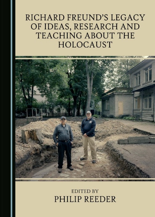
This edited volume can be purchased from the publisher, Cambridge Scholars Publishing.
This webpage will be updated as new data, interpretations and conclusions become available.